Pictured Rocks Vacation Pictured Rocks Up-Close Pictured Rocks Formations Pictured Rocks Tours Pictured Rocks Pictured Rocks Lodging

Experience the Pictured Rocks, a water wonderland filled with great activities and things to see.

Select your way to get up-close to this natural wonder. Colorful cliffs will amaze visitors young and old.

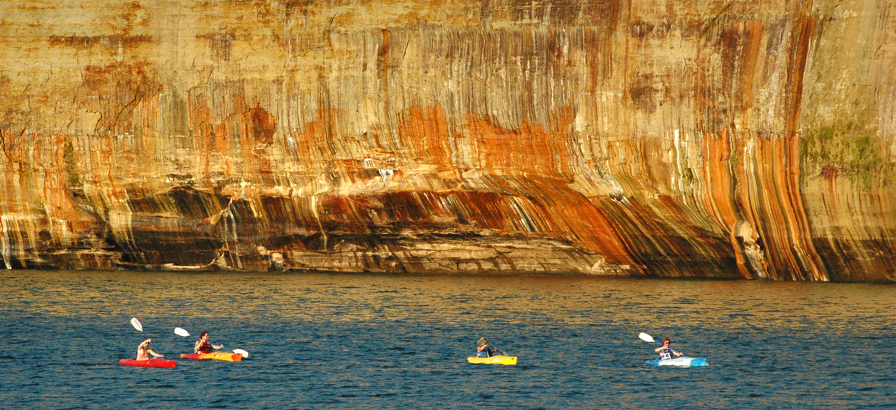
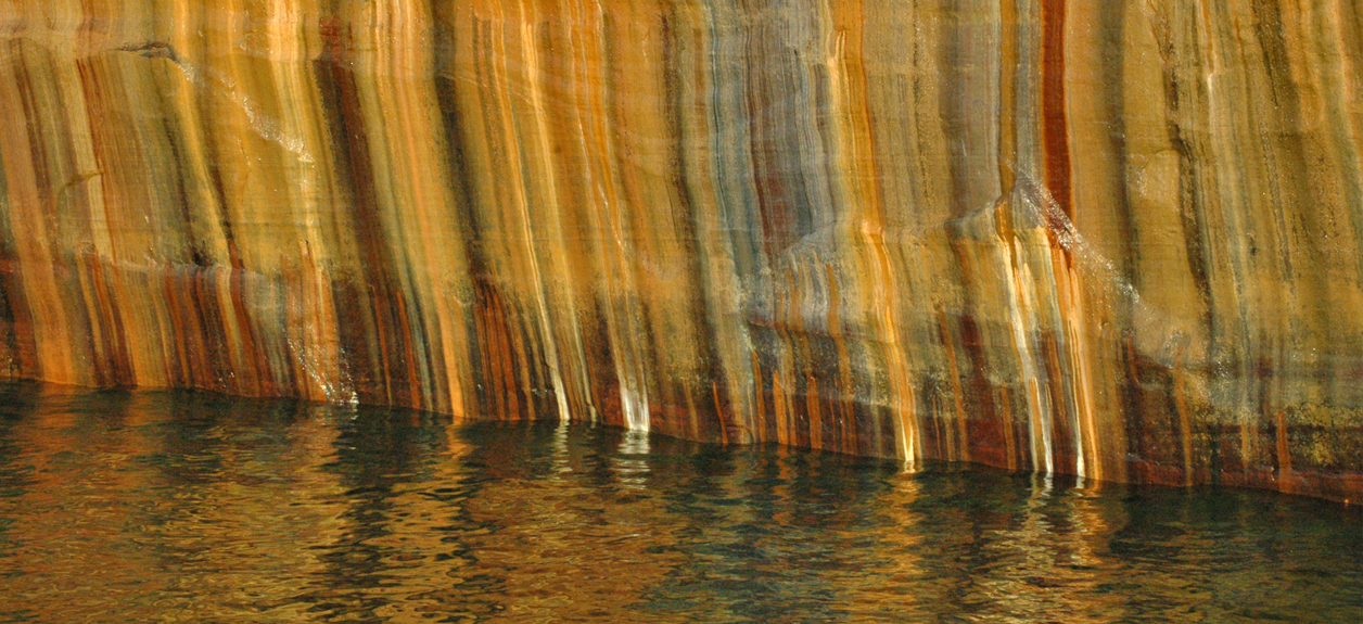
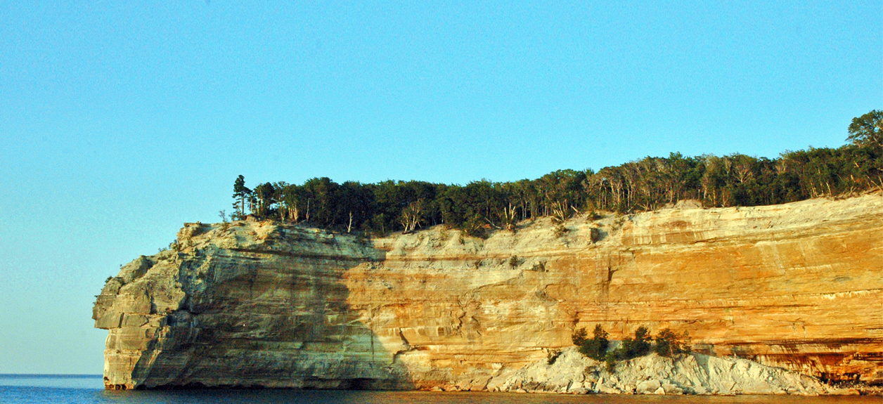
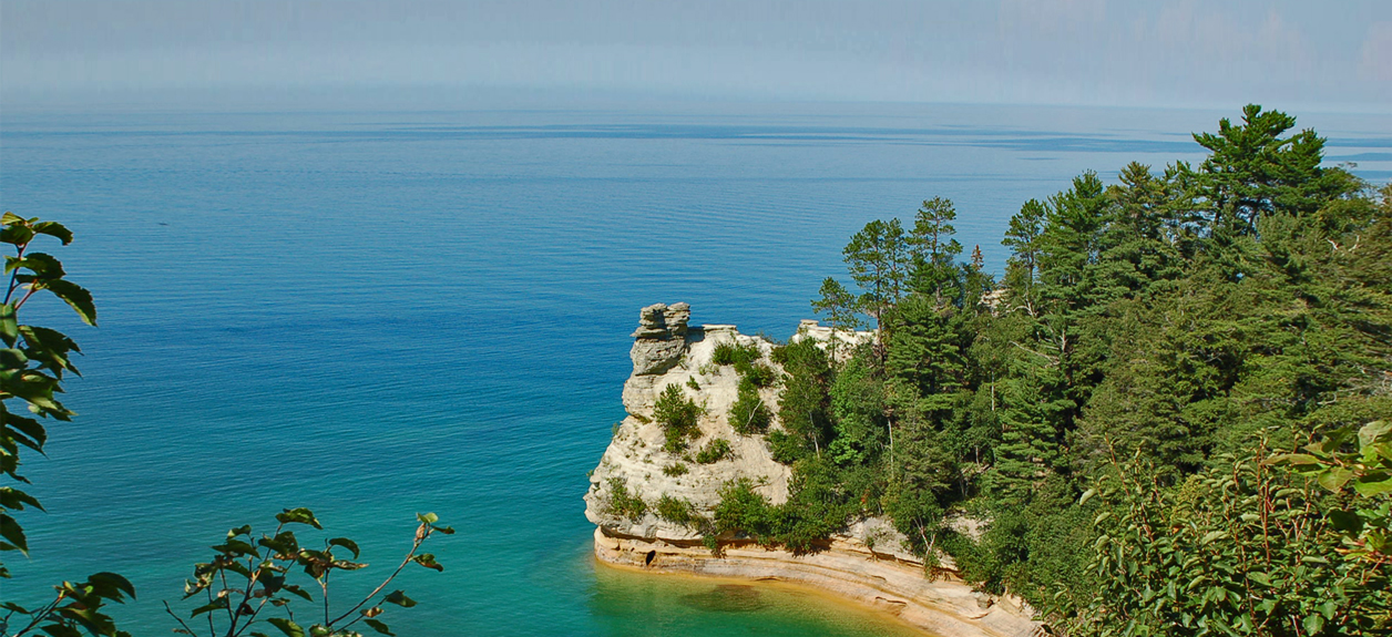
Pictured Rocks formations like Indian Head are sculpted by wind, rain, snow, waves and time.

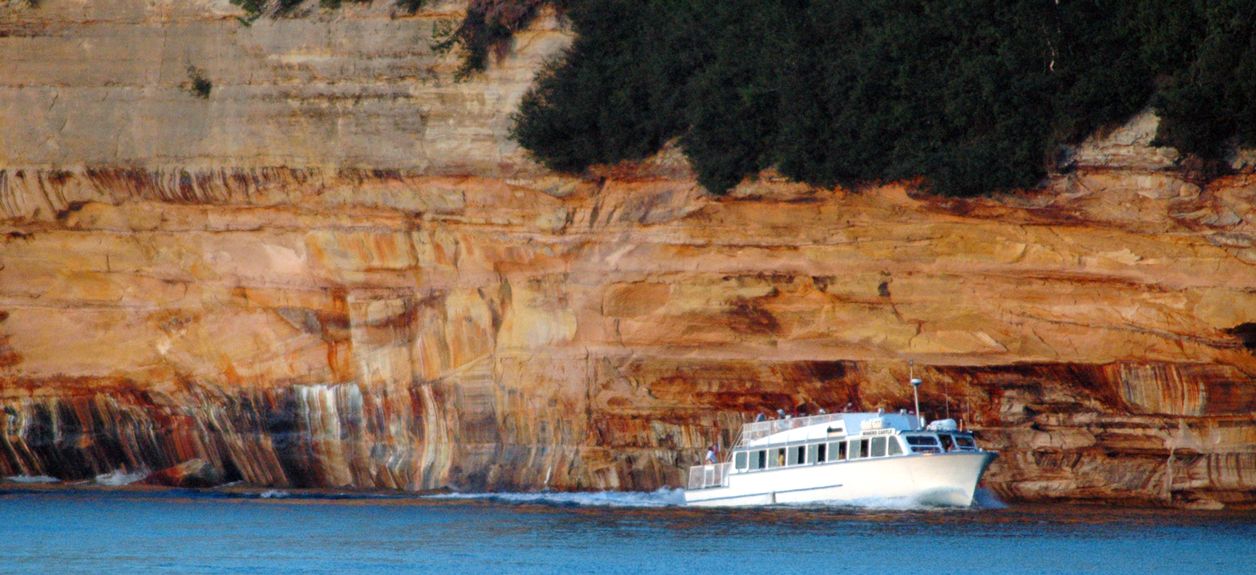
Pictured Rocks local tours deliver many ways to see Munising's natural wonders and shipwrecks.

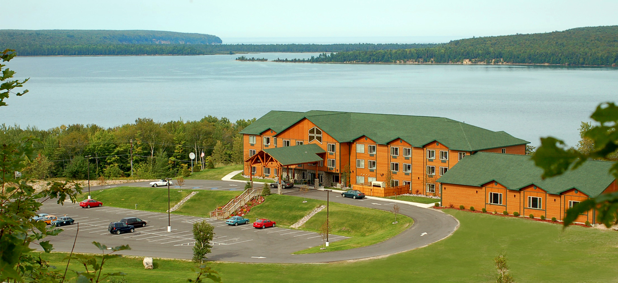
Views of Munising Bay are truly breathtaking.

We offer a variety of lodging in the Pictured Rocks area. Plan your next vacation in Munising.

arrow left
arrow right
Superior Web
The Pictured Rocks Lakeshore have been naturally sculptured by wind, waves and rain into caves, arches, formations that resemble castle turrets, and human profiles, among others. Pictured Rocks National Lakeshore
Upper Peninsula's Pictured Rocks

Welcome to Upper Peninsula's featured attraction, the Pictured Rocks National Lakeshore.  It extends along Lake Superior's shoreline from Munising to Grand Marais, Michigan,  It covers over 42 miles and 73,000 acres.  Pictured Rocks gets its name from the 15 miles of sandstone cliffs northeast of Munising.  This specific region is extremely colorful and unique.  The Pictured Rocks Lakeshore has been naturally sculptured by wind, waves and rain into caves, arches and formations that resemble castle turrets, human profiles and battleships.  The cliff colors are created by large amounts of minerals in the rock. 

Pictured Rocks has worked to make much of its rugged environment accessible:
  • Interagency Visitor Center, Munising Falls Interpretive Center, and Miners Castle Information Station in Munising
  • Grand Sable Visitor Center in Grand Marais
  • Munising Falls viewing platform trail, which is paved
  • Log Slide overlook
  • Miner's Castle overlooks
  • Boardwalk at the Sand Point Marsh Trail
  • Sand Point Beach. Parking and sidewalks are paved. There is a fully accessible picnic site and the boardwalk enables visitors to go part of the way to Lake Superior.
During the Romantic Era of the 1800s, a series of American writers described their feelings upon sight of the Pictured Rocks. Henry Rowe Schoolcraft visited in 1820 and remarked upon "some of the most sublime and commanding views in nature".
Pictured Rocks Highlights
This Fresh Water Destination Rocks!

"This Fresh Water Destination Rocks!".  The Pictured Rocks is one of Michigan's most prized natural wonders.  This extraordinary place that rests along the shores of Lake Superior will delight people of all ages.  By tour boat, foot, bike, pontoon, fishing boat, kayak, canoe, ATV, snowmobile or snowshoes, you will be amazed at the beauty that exists in Munising, Michigan.  Make your reservations with Pictured Rocks Lodging today.

Miners Castle is located 6 1/2 miles east of Munising on Alger County Road H58.  Indian Head is our famous formation that indeed looks a Native American. Chapel Rock is located 15 miles east of Munising off Alger County Road H-58, then about 5 miles north to the end of Chapel Road, then there is a 2 1/2 mile hike to this beautiful formation.

Miner's Castle
Miners Castle is located 6 1/2 miles east of Munising on Alger County Road H58.  There is a platform for visitors, just a short walk from the parking lot.  One of the Pictured Rocks most recognizable formations, it's a must see when visiting Munising.

Indian Head
Formed by wind, waves, and rain, this beautiful spot along the lakeshore will take your breath away.  The Indian Head formation is best viewed by tour boat.
Chapel Rock
Chapel Rock is located 15 miles east of Munising off Alger County Road H-58, then about 5 miles north to the end of Chapel Road. There is a 2 1/2 mile hike to this beautiful formation.  The Chapel area was named by early European explorers.


The Grand Portal is a well known point of interest found within the Pictured Rocks National Lakeshore.


This tour highlight is an imposing arch of rock that extends from the shoreline out to an outcropping located directly in Lake Superior.


By tour boat, foot, bike, pontoon, fishing boat, kayak, canoe, ATV, snowmobile or snow shoes, you will surely be amazed at the beauty that exists here in Munising, Michigan.
Grand Portal
The Grand Portal is a well known point of interest found within the Pictured Rocks National Lakeshore. It has gone through many transformations since its first collapse in 1900. Because of its grandeur, the Grand Portal can be seen for miles.
Lover's Leap
This tour highlight is an imposing arch of rock that extends from the shoreline out to an outcropping located directly in Lake Superior. Lore has it that a couple displayed their love for one another by jumping off the top of this rock arch together. *Note: Do not attempt, water at the base is only a few feet deep. - See more at: http://www.picturedrocks.com/highlights/#sthash.zAh0MFr9.dpuf
This tour highlight is an imposing arch of rock that extends from the shoreline out to an outcropping located directly in Lake Superior. Lore has it that a couple displayed their love for one another by jumping off the top of this rock arch together.
Viewing the Pictured Rocks
By tour boat, foot, bike, pontoon, fishing boat, kayak, canoe, ATV, snowmobile or snowshoes, you will be amazed at the beauty that exists in Munising, Michigan.

Quick Glance of Pictured Rocks National Park Highlights & Munising Bay Points of Interest
From Munising to Grand Marais
  • Indian Head
  • Munising Falls
  • Sand Point
  • Miners Castle
  • Miners River
  • Miners Falls
  • Grand Portal Point
  • Mosquito Falls
  • Mosquito River
  • Chapel Rock
  • Chapel Falls
  • Battleship Rock
  • Beaver Basin Wilderness
  • Twelve-mile Beach
  • Shipwrecks
  • White Birch Forest
  • Au Sable Light
  • Log Slide
  • Grand Sable Dunes
  • Grand Sable Lake
  • Sable Falls